SkyIMD’s Aerial Imaging Expertise & Equipment, Now Available to Everyone!
Call SkyIMD for your aerial image and data acquisition needs.
+1 (510) 223-7500You provide the project, we provide the Planning, Planes, Pilots, and Equipment.
Since 2008, SkyIMD has developed and configured aerial camera and sensor configurations for almost every manned aerial imaging and data acquisition market segment. Some of our previous work:
Aerial Imaging & Data Acquisition Services, Consulting & Training – Available Locally, Nationally & Internationally
|
||||||
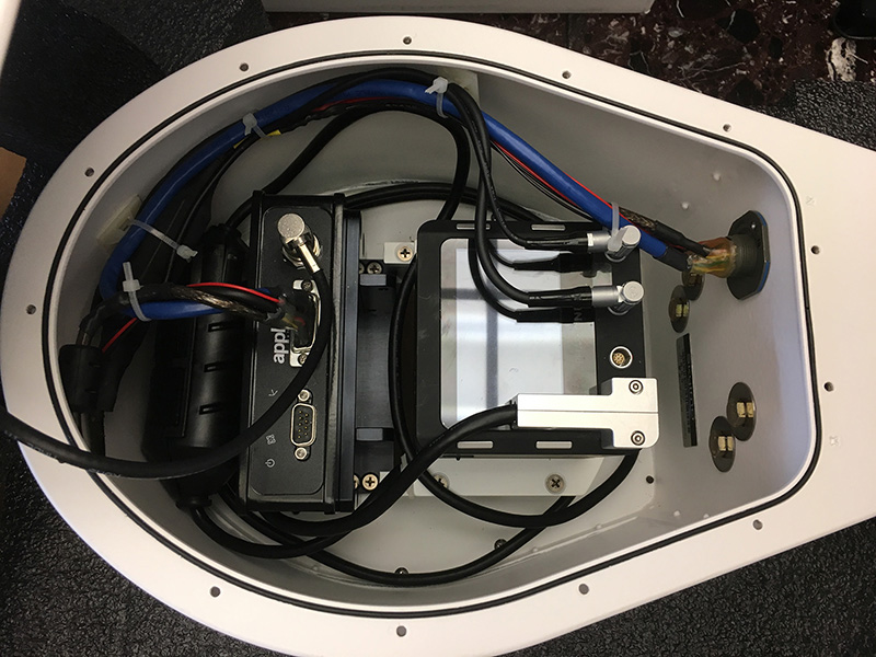
Phase One iXU-RS1000 with Applanix IMU in SkyIMD’s FAA Certified Strut Mount platform. High resolution and precision aerial mapping.
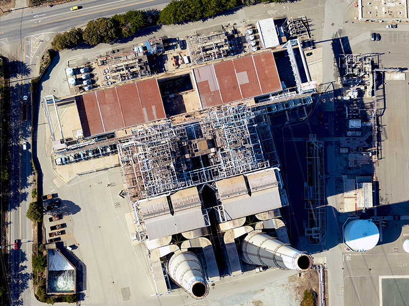
Moss Beach, California Power Plant. Sub 3cm/px GSD. Phase One iXU-RS1000 camera

Oroville Dam in California – orthomosaic – showing the damage after recent overflow from numerous rain storms. Imagery provided to USGS.
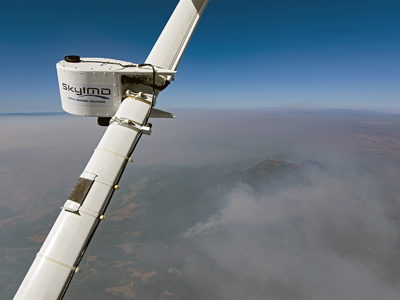
Aerial mapping of the Northern California (Napa Valley) Fires using a Phase One 100 megapixel aerial camera. Mount St. Helena in the background.
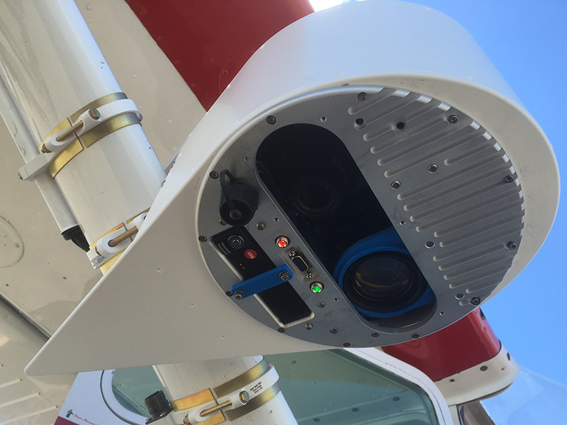
Custom SWIR & VIS Sensor in SkyIMD Pod, with dual swap-able SSD drives. Future proof your data sets, eliminate spectral limitations.
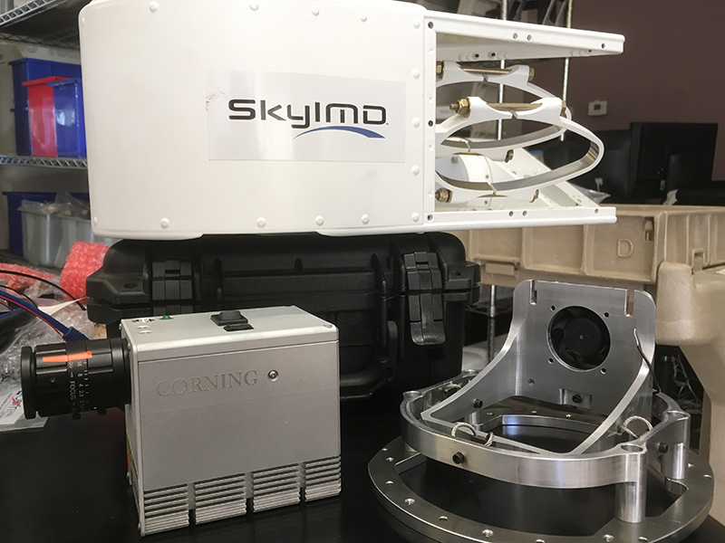
Corning’s Hyperspectral Sensor prior to mounting inside SkyIMD’s FAA Certified aerial camera and sensor platform. Agriculture, Minerals, and Undersea Health are just a few projects that this sensor is ideal for.
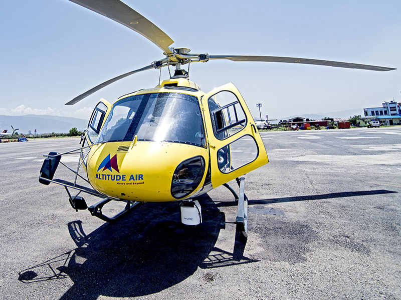
SkyIMD was contacted to map highways in Nepal in 2017. We spent two weeks planning and flying the countries highways using a Phase One 100 megapixel aerial camera mounted inside our STC’d mount on a Eurocopter AS350.
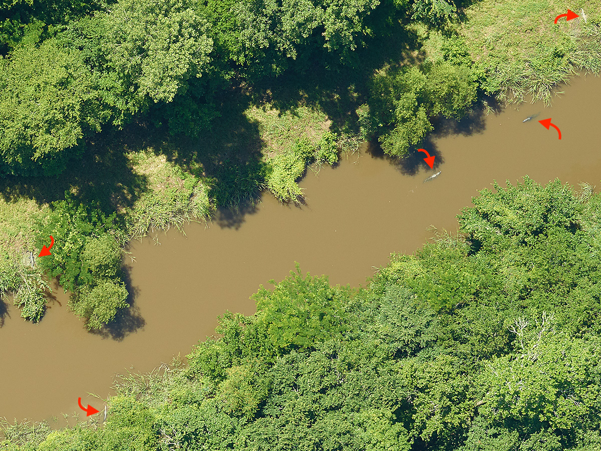
Large parcels of trees were planted to reforest an area outside Baton Rouge, LA. We were contacted to map the area at sub 2cm/px GSD – so that leaf structure could be viewed and analyzed. The red arrows point at five Alligators in this one picture. This is a project that may not be ideal for Drones/UAV’s
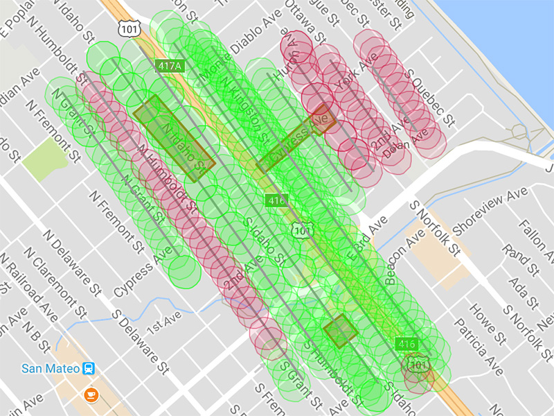
Overlap Assured!! SkyIMD evaluates flight paths and swath widths of every image taken during flight. We can review altitude and spatial resolution, and elect to re-fly a path immediately. We get it right the first time, no re-flights!
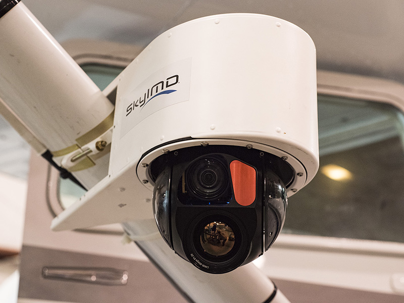
Multiple payload gimbal – FLIR and HD Video – from UAVFactory mounted on a Cessna 182 for Aerial Law Enforcement demonstration – same payloads are used for pipeline, power line, rights of way patrols and for search and rescue efforts.